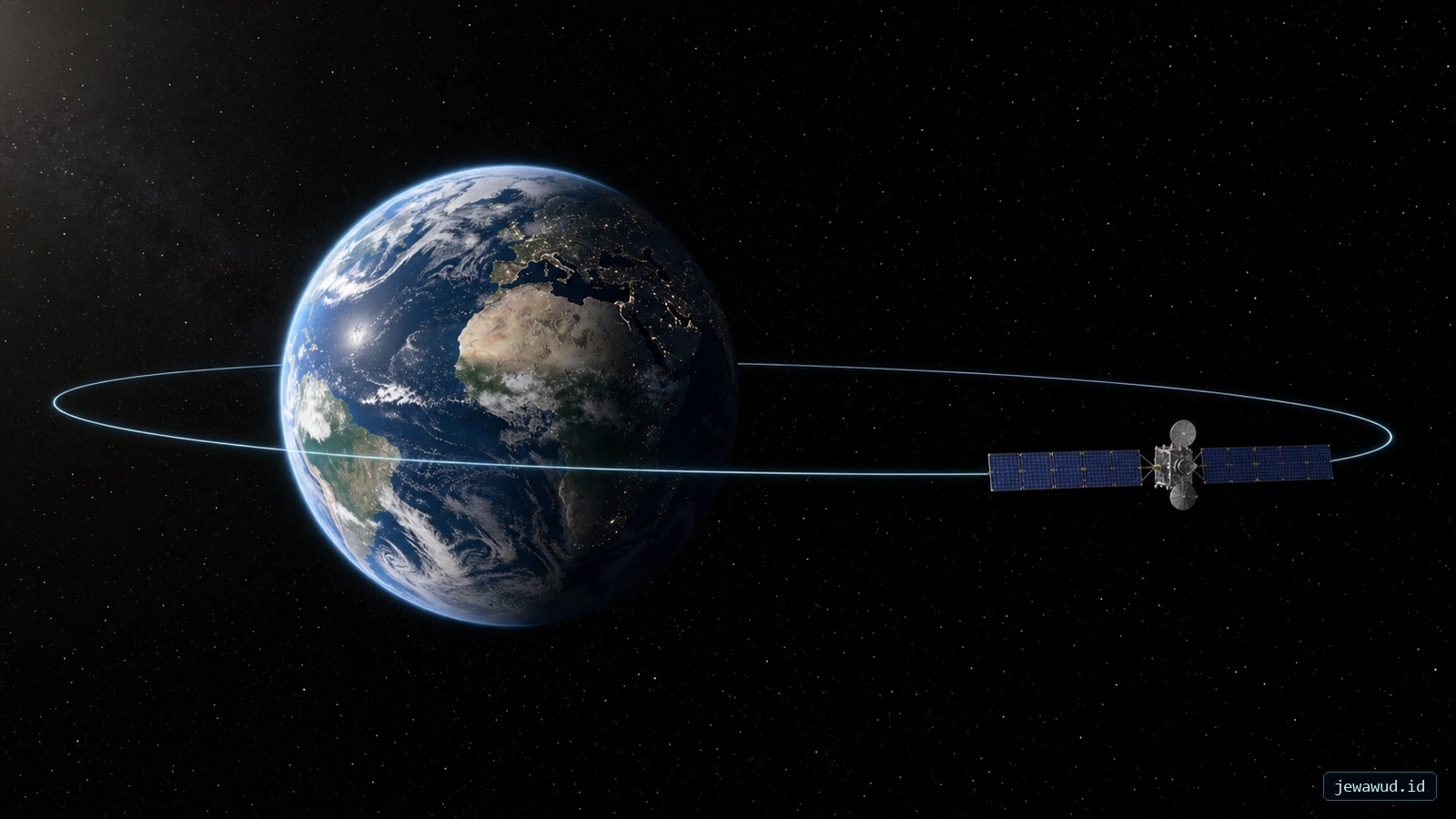
 A communications satellite on Earth's equatorial geostationary belt; satellite size is enlarged for visibility
01Stationary To You, Moving Around Earth
A geostationary satellite is not hovering on engine thrust. It is orbiting eastward in a circular path above the equator, completing a revolution in about 23 hours, 56 minutes and 4 seconds. The ground turns through the same angle, so the satellite stays above one longitude.
There are three geometric requirements as well as the period: prograde motion, zero inclination and zero eccentricity in the ideal case. A 24-hour orbit or a tilted one-day orbit is not the same thing. ESA's communications-orbit guide explains the fixed-view geometry.
 Verified geometry: circular, equatorial, prograde motion with a 23 h 56 min 4 s period produces the 35,786 km GEO altitude
02Where Does 35,786 km Come From?
Start with the circular two-body relation T = 2 pi sqrt(r3 / mu). Solving for radius gives r = [mu (T / 2 pi)2]1/3. Use T = 86,164.0905 seconds and mu = 398,600.4418 km3/s2.
The result is about 42,164.17 km from Earth's centre. Subtract the equatorial radius, 6,378.137 km, to obtain approximately 35,786.03 km altitude. This is a calculated ideal orbit, not an individual satellite's latest telemetry.
Why not use 86,400 seconds? A solar day tracks the Sun's apparent return while Earth also moves around it; a sidereal day tracks Earth's rotation relative to distant stars. Matching the latter produces the fixed longitude. Rounding it to 24 hours is fine for casual speech, but not for this calculation.
03A One-Day Period Can Still Draw A Figure Eight
Geosynchronous describes a period matching Earth's rotation. Geostationary is the circular, equatorial, prograde special case. Inclination makes a geosynchronous satellite move north and south; eccentricity changes its orbital speed and contributes east-west motion. NASA distinguishes the two orbit types.
The illustration below holds eccentricity at zero and inclination at 20 degrees. In this ideal model, the ground point reaches 20 degrees north and south, while longitude varies only about 1.8 degrees either side of its centre. The figure eight is local: it does not sweep across the entire world map.
Those values follow by projecting circular orbital motion onto the equator and subtracting Earth's uniform rotation. Changing eccentricity changes the shape, so the same figure eight should not be used as a universal drawing for every geosynchronous object.
 Calculated circular example: i = 20 degrees gives latitude limits of ±20 degrees and a local longitude excursion of only about ±1.8 degrees
04A Dish Does Not Point To The Satellite's Map Latitude
The sub-satellite point of ideal GEO lies on the equator. That does not mean a dish elsewhere on Earth points horizontally toward the equator. It points along a three-dimensional line from the antenna to the spacecraft; its elevation depends on the observer's latitude and difference in longitude from the satellite.
In a spherical model, the maximum surface separation from the sub-satellite point at the zero-elevation horizon is acos(R / r). Using the radii above gives approximately 81.3 degrees. The poles are 90 degrees from every equatorial point, so an ideal GEO satellite is below their horizon.
Buildings and a required elevation margin reduce that geometric reach. A visible satellite can still be outside a particular communications beam. Coverage geometry, the antenna pointing direction and an operator's service map answer different questions.
05Count Signal Legs Before Quoting Latency
For an Earth-to-satellite-to-Earth relay, a lower-bound path length is twice the altitude. At 35,786 km, 2 x 35,786 / 299,792.458 is about 0.239 seconds one way through the relay. A response returning over an equivalent relay path adds two more legs: about 0.477 seconds round trip.
These are ideal vacuum propagation bounds, not measured internet ping times. Real slant paths are longer, and processing, routing and queues add delay. A single ground-to-satellite leg is roughly half the two-leg figure; confusing the leg count is why quoted GEO delays can look contradictory.
The benefit is persistence: fixed antennas can maintain a link, and one transmission can reach receivers across a broadcast footprint. ESA describes this relay and broadcast role.
06Reaching A Slot Is Different From Keeping It
A geostationary transfer orbit is elliptical. Reaching its high point near GEO altitude does not finish insertion: further velocity changes raise the low point and remove the remaining inclination. ESA's GTO description illustrates that sequence. The Hohmann transfer article treats the simplified two-burn geometry.
A longitude is not a permanent parking clamp. Real orbits experience perturbations, and operators perform station keeping. NOAA describes these corrective burns in its satellite-orbit overview. Small motion within a maintained region is compatible with a working GEO satellite; a catalog position alone does not prove that it is operational.
07Check Four Numbers In The Catalog
Open the Jewawud satellite catalog and inspect a candidate's period, inclination, eccentricity and epoch. A period near a sidereal day is only the first check. Significant inclination or eccentricity rules out the ideal fixed-point model even when the altitude looks familiar.
Then compare its ground position in JOT (Jewawud Orbital Tracker). Preserve the timestamp and source epoch when comparing displays. A marker that barely changes over a few seconds is not enough to establish geostationary motion; stale data and a paused display can also look still. Do not infer radio service or active station keeping without operator evidence.
Inspect The Orbit, Not Just The Height
Compare period, inclination and eccentricity before interpreting a fixed-looking marker.
Open Satellite Catalog