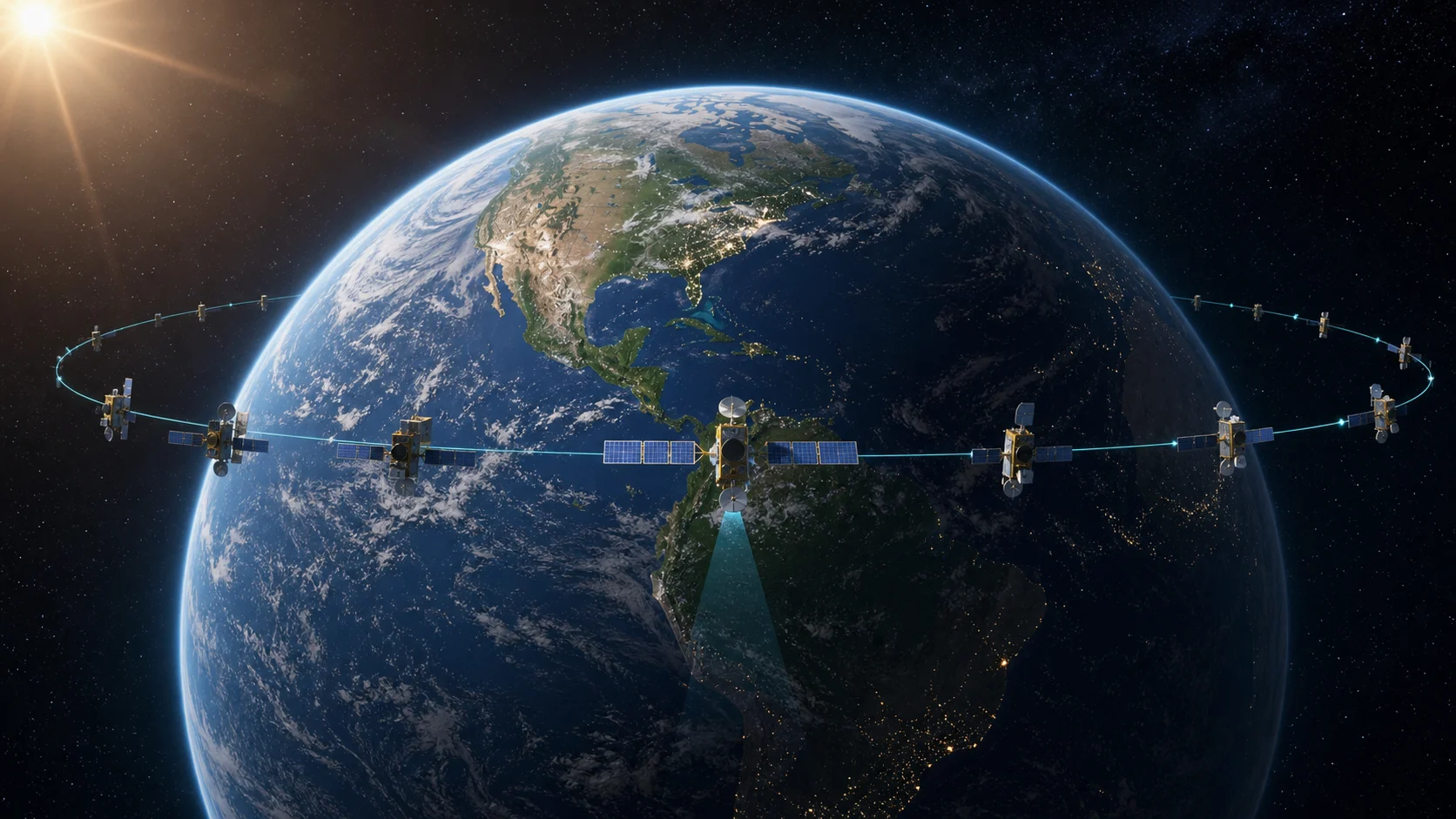
 GEO satellites remain near fixed longitudes above the equator
01The Basic Definition
A geostationary satellite orbits above Earth's equator with a period that matches Earth's rotation. Because the satellite moves around Earth at the same rate that Earth turns, it appears to hover over nearly the same longitude. To an observer on the ground, it is almost fixed in the sky.
This is different from most low Earth orbit satellites, which sweep overhead for only a few minutes at a time. GEO satellites trade closeness for persistence. They are much farther away, but that distance lets them see a huge region of Earth continuously.
02Why The Equator Matters
For a satellite to be truly geostationary, it must be in a circular orbit above the equator. If the orbit is inclined, the satellite will appear to trace a north-south figure in the sky each day. If the orbit is eccentric, it will drift east-west as well. The familiar fixed-point behavior requires the right altitude, low eccentricity, and near-zero inclination.
That precision is why operators perform station keeping. Small gravitational effects from the Moon, Sun, and Earth's uneven mass distribution slowly disturb the orbit. The satellite uses fuel to remain inside its assigned orbital slot. When fuel runs low, operators may move it to a disposal orbit above GEO.
03Why GEO Is Useful
Geostationary orbit is ideal for fixed communications, broadcast television, weather observation, and regional monitoring. A ground antenna can point toward the satellite and stay there. A weather satellite can watch the same hemisphere for storms, cloud movement, and large-scale patterns. A communications satellite can serve a wide footprint without constant handover.
The tradeoff is distance. Signals must travel much farther than they would to a LEO satellite, which adds latency. Launching to GEO also requires more energy. The satellite itself must be built for a harsher radiation environment and long operational life. GEO is powerful, but it is not cheap or simple.
04GEO vs Geosynchronous
People often use geostationary and geosynchronous interchangeably, but they are not exactly the same. A geosynchronous orbit has a period that matches Earth's rotation. A geostationary orbit is a special geosynchronous orbit that is circular and equatorial. All geostationary orbits are geosynchronous, but not all geosynchronous orbits are geostationary.
The difference matters when reading satellite data. If an object has a one-day period but noticeable inclination, it may not stay fixed in one point in the sky. It may drift through a daily pattern. A good tracker should help users see this behavior instead of only listing a category name.
05How Satellites Reach GEO
Many GEO missions first enter a geostationary transfer orbit. The launcher raises the spacecraft's apogee toward geostationary altitude. The spacecraft then performs additional burns to circularize, adjust inclination, and settle into its assigned longitude. Electric propulsion missions may take longer but use propellant more efficiently.
This transfer phase is a direct cousin of the Hohmann transfer concept. The spacecraft does not simply fly straight upward to GEO. It changes orbit shape, coasts, circularizes, and trims. Seeing that sequence in a planner makes the final orbit feel less mysterious.
06Orbital Slots
Because GEO satellites appear fixed, longitude slots are valuable. Two satellites too close together in the same radio bands can interfere. Operators coordinate positions, frequencies, and service areas. The ring above the equator is physically large, but useful slots are still managed carefully.
From a user perspective, the idea is simple: a GEO satellite is not just "somewhere high up." It is assigned a neighborhood over a specific longitude. That location determines which regions it can serve and where ground antennas point.
07How It Looks In A Tracker
On a live orbital map, GEO satellites should look calm compared with LEO satellites. Their ground positions cluster near the equator and change slowly. If the app draws orbit paths, the scale should make it clear that GEO is far above low orbit. If everything is drawn with the same visual radius, users may misunderstand the real geometry.
Telemetry helps solve that. Altitude, period, inclination, and longitude together explain why the satellite behaves the way it does. A GEO object with a period near one day and very low inclination is different from a fast LEO object even if both appear as dots on the same globe.
08Coverage And Limits
A single geostationary satellite can see a large portion of Earth, but it cannot see everything. Because it sits above the equator, coverage is strongest across the hemisphere facing the satellite and weaker toward high latitudes. Polar regions are difficult from GEO because the satellite appears low on the horizon or below it. This is why some missions use highly elliptical orbits or polar systems instead of relying on GEO alone.
For communications, the fixed viewpoint is extremely useful. Ground terminals can use fixed antennas, broadcast beams can be shaped for specific regions, and operators can maintain consistent service areas. For weather, the fixed view allows continuous monitoring of cloud systems as they evolve. A GEO weather image is not just a pretty Earth picture; it is a persistent watch over a region.
But GEO also creates delay. Radio signals travel to the satellite and back, and that distance is large. For television broadcast, the delay is acceptable. For interactive internet or voice links, the delay can be noticeable. Low Earth orbit constellations try to solve that latency problem by using many closer satellites, but they require complex handovers and many moving nodes.
The best orbit depends on the task. GEO is excellent when fixed coverage matters more than low latency or close-up detail. LEO is excellent when proximity, resolution, or latency matter. MEO is often a middle path for navigation. Seeing these differences in an orbital map helps users understand why space systems are designed as families, not as one universal orbit.
09Why GEO Looks Misleading On Maps
Many maps flatten Earth into a rectangle. On that kind of map, geostationary satellites may look like dots along a line near the equator. That is useful, but it hides the three-dimensional scale. On a globe, GEO is far above the surface. On a flat map, the altitude disappears and only longitude remains. Both views are useful if the user knows what each view is showing.
A strong tracker can combine them. The globe explains height and geometry. The map explains longitude and coverage. The telemetry explains the actual numbers. When those three layers agree, a user can understand why a satellite appears fixed, why it serves a region, and why moving it to another slot is not just a graphical change but an orbital operation.
10What To Compare
When comparing GEO with other satellites, focus on period, altitude, inclination, and ground motion. A low Earth orbit satellite may have a period near ninety minutes and a fast ground track. A GEO satellite has a period near one day and very slow apparent ground motion. If the inclination is close to zero, it should stay near the equator.
This comparison is more useful than memorizing one altitude number. The altitude explains why the period is long. The period explains why the satellite appears fixed. The low inclination explains why the fixed point is near the equator. The longitude explains which region the satellite serves. Together, those values turn GEO from a definition into a working system.
For search visitors, this is the useful takeaway: geostationary orbit is not just high orbit. It is a carefully maintained relationship between altitude, period, equatorial geometry, and service longitude. Once that relationship is clear, fixed satellite dishes, weather images, and orbital slots all make more sense. The orbit becomes a service platform, not only a path around Earth.
FAQQuick Questions
Is GEO the same as geostationary? GEO usually refers to the geostationary region, but geostationary is the precise circular equatorial case.
Why are GEO satellites high? That altitude gives them an orbital period matching Earth's rotation.
Do GEO satellites move? Yes, they orbit Earth, but from the ground they appear nearly fixed.
Compare GEO In JOT
Use the tracker to compare low orbit motion with high orbit satellites and see why GEO looks almost still.
Open Live Orbital Map